Balfour, Mpumalanga
Appearance
This article needs additional citations for verification. (September 2014) |
Balfour | |
|---|---|
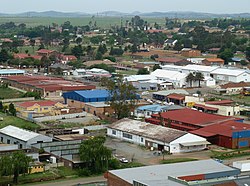
 Skyline photo of central Balfour | |
| Coordinates: 26°39′S 28°35′E / 26.650°S 28.583°E | |
| Country | South Africa |
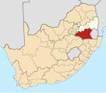
| Province | Mpumalanga |
| District | Gert Sibande |
| Municipality | Dipaleseng |
| Area | |
• Total | 12.06 km2 (4.66 sq mi) |
| Population (2011)[1] | |
• Total | 3,201 |
| • Density | 270/km2 (690/sq mi) |
| Racial makeup (2011) | |
| • Black African | 50.2% |
| • Coloured | 1.4% |
| • Indian/Asian | 9.4% |
| • White | 38.4% |
| • Other | 0.6% |
| First languages (2011) | |
| • Afrikaans | 5.6% |
| • Zulu | 60.7% |
| • English | 15.4% |
| • Sotho | 40.3% |
| • Other | 10.7% |
| Time zone | UTC+2 (SAST) |
| Postal code (street) | 2410 |
| PO box | 2410 |
| Area code | +27 17 773 |
Balfour is a developing gold mining and maize farming town in Mpumalanga, South Africa.
History
[edit]The town and post office, some 80 kilometres (50 mi) southeast of Johannesburg, was established on the farms Vlakfontein No. 101 and No. 108 which belonged to Frederick Stuart McHattie, and named McHattiesburg after him in 1897. Proclaimed on 16 February 1898, it was renamed Balfour on 15 February 1905, after Arthur James Balfour, Prime Minister of Great Britain, 1902–1905, who visited South Africa in that year.[2]
References
[edit]- ^ a b c d "Main Place Balfour". Census 2011.
- ^ Raper, Peter E. (1987). Dictionary of Southern African Place Names. HSRC. p. 68.
![]() Media related to Balfour at Wikimedia Commons
Media related to Balfour at Wikimedia Commons


