Kalmar
Kalmar | |
|---|---|
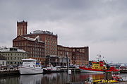
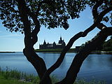
 Clockwise from top: aerial view of the Kalmar Cathedral, Kalmar Castle, the old water tower in central Kalmar, Öland Bridge and the water tower in Berga. | |
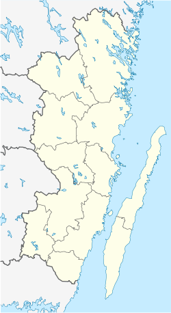
| Coordinates: 56°39′41″N 16°21′46″E / 56.66139°N 16.36278°E | |
| Country | |
| Province | Småland |
| County | Kalmar County |
| Municipality | Kalmar Municipality |
| Charter | 1100 |
| Area | |
| • City | 19.50 km2 (7.53 sq mi) |
| Elevation | 8 m (26 ft) |
| Population (2020)[1] | |
| • City | 41,852 |
| • Density | 1,866/km2 (4,830/sq mi) |
| • Metro | 72,098 |
| Time zone | UTC+1 (CET) |
| • Summer (DST) | UTC+2 (CEST) |
| Postal code | 39x xx |
| Area code | (+46) 480 |
| Website | kalmar |
Kalmar (/ˈkælmɑːr/, US also /ˈkɑːlmɑːr/,[2][3] Swedish: [ˈkǎlmar] ) is a city in the southeast of Sweden, situated by the Baltic Sea. It had 41,388 inhabitants in 2020[1] and is the seat of Kalmar Municipality. It is also the capital of Kalmar County, which comprises 12 municipalities with a total of 236,399 inhabitants (2015). Kalmar is the third largest urban area in the province and cultural region of Småland.
From the thirteenth to the seventeenth centuries, Kalmar was one of Sweden's most important cities. Its name was until the second half of the nineteenth century spelled Calmar. Between 1602 and 1913 it was the episcopal see of Kalmar Diocese, with a bishop, and the Kalmar Cathedral from 1702 is an example of classicistic architecture. It became a fortified city, with the Kalmar Castle as the center. After the Treaty of Roskilde in 1658, Kalmar's importance diminished, until the industry sector was initiated in the 19th century. The city is home to parts of Linnaeus University.
The city plays host to the Live at Heart festival, one of Sweden's largest musical showcase events.
Kalmar is adjacent to the main route to the island of Öland over the Öland Bridge.
History
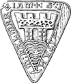
[edit]The area around Kalmar has been inhabited since ancient times. Excavations have found traces of Stone Age gravefields. However, the oldest evidence for there being a town is from the 11th century. According to a medieval folk tale, the Norwegian king Saint Olav had his ships moved to Kalmar. The oldest city seal of Kalmar is from somewhere between 1255 and 1267, making it the oldest known city seal in Scandinavia.[citation needed]
In the 12th century the first foundations of a castle were established, with the construction of a round tower for guard and lookout. The tower was continuously expanded in the 13th century, and as such, Queen Margaret called an assembly there between the heads of state of Sweden and Norway, and on 13 July 1397, the Kalmar Union treaty was signed, creating a union which would last until 1523. Kalmar's strategic location, near the Danish border (at the time the Scanian lands, i.e. the provinces of Blekinge, Halland and Scania, were part of Denmark), and its harbour and trade, also involved it in several feuds. There are two events independently labelled the Kalmar Bloodbath, 1505: the first in 1505, when King John of Denmark, Norway, and Sweden had the mayor and city council of Kalmar executed; the second in 1599 by command of Duke Charles, later to become King Charles IX of Sweden.

In the 1540s, first King Gustav Vasa, and later his sons Erik XIV of Sweden and John III of Sweden would organize a rebuilding of the castle into the magnificent Renaissance castle it is today.
Kalmar became a diocese of the Church of Sweden in 1603, a position it held until 1915. In 1634, Kalmar County was founded, with Kalmar as the natural capital. In 1660, the Kalmar Cathedral was begun by drawings of Nicodemus Tessin the Elder. It would be inaugurated in 1703.
In 1611–1613, it suffered in the Kalmar War, which began with a Danish siege of Kalmar Castle. 1611 is mentioned as the darkest year of Kalmar's history, but by no means the only dark year; much blood has been shed in the vicinity of the castle. The last was during the Scanian War in the 1670s, so there have been 22 sieges altogether; however the castle was never taken.
After the Treaty of Roskilde in 1658, the strategic importance of Kalmar gradually diminished as the borders of Sweden were redrawn further south. In 1689, the King established his main naval base further south in Karlskrona and Kalmar lost its status as one of Sweden's main military outposts.
Kalmar Cathedral
[edit]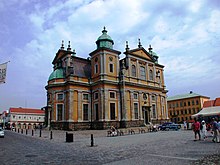
The new city of Kalmar was built on Kvarnholmen around the mid-1600s. The transfer from the old town was largely completed by 1658. The new, fortified town was planned following current baroque patterns. Cathedral and town hall face each other across the new main square, Stortorget.
The cathedral was designed by Nicodemus Tessin the Elder and is one of the foremost examples of baroque classicism in Sweden. Its design reflects the complex interaction between the new style, liturgical considerations, tradition and the fortress-city requirements. The work began in 1660, but it was interrupted on several occasions, including when the Scanian War (1675–1679) raged. Construction resumed, and Kalmar Cathedral stood finished in 1703.
Today
[edit]In more recent times, Kalmar has been an industrial city with Kalmar Verkstad making steam engines, trains and large machinery, later bought by Bombardier who closed the factory in 2005. A shipyard, Kalmar Shipyard, was founded in 1679 and closed 1981. Volvo opened their Kalmar factory for building cars i.e. 264, 740, 760, 960 in 1974, but closed it 1994 and due to further relocation of industry jobs in the 1990s and 2000s around 2000 industrial jobs were lost. Kalmar has a university with over 9,000 students and a research facility for Telia Sonera.
Kalmar has embarked on a comprehensive program to reduce fossil fuel use. A local trucking firm, which employs nearly 450 people, has installed computers that track fuel efficiency and have cut diesel use by 10 percent, paying off the cost of the devices in just a year. The company is now looking to fuel its future fleet with biodiesel.[4]
A large wood pulp plant harnesses the steam and hot water it once released as waste to provide heating, through below-ground pipes, and generates enough electricity to power its own operations and 20,000 homes.[4]
Bicycle lanes are common; for example, the Kalmarsundsleden,[5] and cars line up at Kalmar city's public biogas pump. Building codes now require thermal insulation and efficient windows for new construction or retrofits. Street lights use low-energy sodium bulbs, and car dealers promote fuel-efficient and hybrid vehicles.[4]
In 2011 Guldfågeln Arena was initiated. It is the new stadium of the football team of the city, Kalmar FF. The capacity of the stadium is 12,000 people and it is currently one of the newest stadiums in Sweden. The stadium was also built to host concerts and did so in the summer of 2011 when Swedish artists Håkan Hellström and The Ark performed.
Climate
[edit]Kalmar has an oceanic climate using the -3°C isotherm or a warm-summer humid continental climate using the 0°C isotherm.[6] Summers are warm and winters are fairly cold with temperatures normally hovering around zero. Kalmar is among the hottest Swedish cities, with an all-time record set at 35.2 °C (95.4 °F).[7] The average summer temperatures however are typical for southern Sweden.
| Climate data for Kalmar (2002–2020); extremes since 1901 | |||||||||||||
|---|---|---|---|---|---|---|---|---|---|---|---|---|---|
| Month | Jan | Feb | Mar | Apr | May | Jun | Jul | Aug | Sep | Oct | Nov | Dec | Year |
| Record high °C (°F) | 11.6 (52.9) |
17.0 (62.6) |
20.6 (69.1) |
25.7 (78.3) |
32.5 (90.5) |
33.0 (91.4) |
35.2 (95.4) |
33.1 (91.6) |
28.5 (83.3) |
23.5 (74.3) |
17.4 (63.3) |
13.2 (55.8) |
35.2 (95.4) |
| Mean maximum °C (°F) | 8.5 (47.3) |
8.7 (47.7) |
14.9 (58.8) |
18.9 (66.0) |
23.5 (74.3) |
27.2 (81.0) |
28.1 (82.6) |
27.2 (81.0) |
22.7 (72.9) |
17.6 (63.7) |
12.5 (54.5) |
9.2 (48.6) |
29.4 (84.9) |
| Mean daily maximum °C (°F) | 2.3 (36.1) |
2.8 (37.0) |
6.4 (43.5) |
11.4 (52.5) |
16.3 (61.3) |
20.6 (69.1) |
22.6 (72.7) |
22.1 (71.8) |
18.0 (64.4) |
11.9 (53.4) |
7.2 (45.0) |
3.9 (39.0) |
12.1 (53.8) |
| Daily mean °C (°F) | −0.5 (31.1) |
−0.2 (31.6) |
2.3 (36.1) |
6.2 (43.2) |
10.8 (51.4) |
15.1 (59.2) |
17.5 (63.5) |
16.9 (62.4) |
13.3 (55.9) |
8.3 (46.9) |
4.6 (40.3) |
1.3 (34.3) |
8.0 (46.3) |
| Mean daily minimum °C (°F) | −3.2 (26.2) |
−3.1 (26.4) |
−1.8 (28.8) |
1.0 (33.8) |
5.3 (41.5) |
9.6 (49.3) |
12.3 (54.1) |
11.7 (53.1) |
8.6 (47.5) |
4.6 (40.3) |
2.0 (35.6) |
−1.3 (29.7) |
3.8 (38.9) |
| Mean minimum °C (°F) | −14.9 (5.2) |
−13.8 (7.2) |
−10.0 (14.0) |
−5.2 (22.6) |
−1.7 (28.9) |
3.0 (37.4) |
6.6 (43.9) |
4.9 (40.8) |
1.2 (34.2) |
−3.8 (25.2) |
−6.7 (19.9) |
−11.4 (11.5) |
−17.7 (0.1) |
| Record low °C (°F) | −31.0 (−23.8) |
−26.5 (−15.7) |
−27.6 (−17.7) |
−12.7 (9.1) |
−5.8 (21.6) |
−1.2 (29.8) |
2.6 (36.7) |
0.4 (32.7) |
−5.7 (21.7) |
−8.8 (16.2) |
−17.3 (0.9) |
−25.3 (−13.5) |
−31.0 (−23.8) |
| Average precipitation mm (inches) | 36.3 (1.43) |
33.9 (1.33) |
27.1 (1.07) |
24.8 (0.98) |
37.8 (1.49) |
42.1 (1.66) |
75.3 (2.96) |
60.2 (2.37) |
32.9 (1.30) |
53.4 (2.10) |
57.1 (2.25) |
42.3 (1.67) |
523.2 (20.61) |
| Source 1: SMHI[8] | |||||||||||||
| Source 2: SMHI Monthly Data 2002–2020[9] OGIMET[10] | |||||||||||||
Gallery
[edit]History
[edit]-
The seal of Kalmar, 13th century
-
Engraving from Suecia antiqua et hodierna, circa 1700
-
Town plan, 1906
Main sights
[edit]-
Town hall
-
In 1972, the 6 km (4 mi) long Öland bridge was built from Kalmar to the town of Färjestaden on Öland
-
Kalmar County Museum
General views
[edit]-
Main square
-
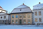
Houses on the main square
-
Street in Kalmar
-
Square in Kalmar
-
Scenic photograph of Kalmar Castle in the summer sun
-
Mermaid sculpture Kalmar
Sports
[edit]The following sports clubs are located in Kalmar:
Notable people
[edit]- Khamzat Chimaev - UFC Fighter
- Mikael Adolphson – historian
- Charlotta Djurström – theatre director
- Helena Josefsson – musician, lead singer in Sandy Mouche
- Ivar Kreuger – civil engineer and industrialist
- Jangir Maddadi – designer living in Kalmar
- Carl Gustaf Mosander – chemist who discovered lanthanum, erbium, terbium
- Anna-Stina Nilstoft – painter
- Jenny Nyström – painter and illustrator
- Henrik Strindberg – composer
- Hans Villius – historian
Twin towns – sister cities
[edit]Kalmar is twinned with eleven cities:[11]
 Árborg, Iceland
 Arendal, Norway
 Entebbe, Uganda
 Gdańsk, Poland
 Kaliningrad, Russia
 Panevėžys, Lithuania
 Samsun, Turkey
 Savonlinna, Finland
 Silkeborg, Denmark
 Wilmington, United States
 Wismar, Germany
See also
[edit]- Kalmar Municipality
- Kalmar Airport
- Kalmar Verkstad
- Spawn of Possession
- Linnaeus University
- Kalmar Nyckel, historical ship named after the city of Kalmar
- Kalmar FF, premier division football club from the city
- Ragnarök
Notes
[edit]- ^ a b c "Tätorternas landareal, folkmängd och invånare per km2 2005 och 2010" (in Swedish). Statistics Sweden. 14 December 2011. Archived from the original on 27 January 2012. Retrieved 10 January 2012.
- ^ "Kalmar"[dead link] (US) and "Kalmar". Lexico UK English Dictionary. Oxford University Press. Archived from the original on 4 August 2022.
- ^ "Kalmar". Merriam-Webster.com Dictionary. Merriam-Webster. Retrieved 31 January 2019.
- ^ a b c Going green: Entire Swedish city switches to biofuels to become environmentally friendly Archived 6 March 2009 at the Wayback Machine
- ^ "Archived copy" (PDF). Archived from the original (PDF) on 20 September 2013. Retrieved 12 April 2013.
{{cite web}}: CS1 maint: archived copy as title (link) - ^ "Kalmar, Sweden Climate Summary". Weatherbase. Retrieved 21 April 2015.
- ^ "Monthly Weather Data - July 2014 (all-time records section)" (PDF). SMHI. Retrieved 21 April 2015.
- ^ "SMHI Open Data" (in Swedish). Swedish Meteorological and Hydrological Institute. Retrieved 3 June 2021.
- ^ "Yearly and Monthly Statistics" (in Swedish). SMHI. 3 June 2021.
- ^ "02670: Kalmar Flygplats (Sweden)". OGIMET. 26 February 2021. Retrieved 26 February 2021.
- ^ "Våra vänorter". kalmar.se. Archived from the original on 27 April 2014. Retrieved 27 April 2014.
References
[edit]- (in Swedish) Article Kalmar, Nordisk familjebok, Kalmar domkyrkas historia
External links
[edit]- Kalmar Municipality – Official site
- iKalmar – a social network for citizens of Kalmar
- Kalmar Castle
- Kalmar City – pictures from nightlife in Kalmar
- University of Kalmar
- Barometern Oskarshamns-Tidningen – daily newspaper from Kalmar and Oskarshamn
- Kalmar
- Populated places in Kalmar County
- Populated places in Kalmar Municipality
- Municipal seats of Kalmar County
- Coastal cities and towns in Sweden
- Port cities and towns of the Baltic Sea
- County seats in Sweden
- Swedish municipal seats
- Viking Age populated places
- Populated places established in the 12th century
- 11th-century establishments in Sweden
- Cities in Kalmar County
- Kalmar Union


